School district superintendents and planners have tough decisions to make when school facilities are not being utilized efficiently. Having data and solid plans to back those decisions up is essential. If you could plan for change in your district using what-if scenarios, what might those look like?
If, for example, you needed to consider closing a school because your district’s enrollment has been dropping, you might first open a map of your district and school boundaries on your computer. (A note: not all districts have accurate school boundaries on a computerized map. So, just having this would be a huge first step.)
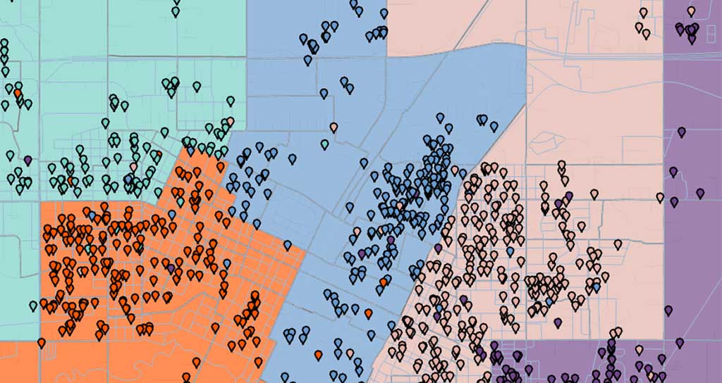
This map would show your school attendance boundaries and a dot on the residence of each student enrolled in the district. (This is called geocoding—a geographic marker that represents a student.)
Plus, you would have a numeric chart with counts of the number of students at each school broken down by grade and demographic category, such as ethnicity, program participation, primary language, and special education. Ideally, you would also have the school capacities, percent utilization, and seats available at each school to tell you which schools are under and which are over capacity, and by how much. Even better, these numbers would all change dynamically when you make a change to your boundaries.
In a what-if scenario, to simulate closing a school, you would simply delete the school icon from your online map and see that the area around the school and all the students who live in that area are no longer assigned to a school. You would click a button to select the unassigned planning areas and assign them to other schools. You would check your chart to see the impact on enrollments at the remaining schools. You would study the results and reassign some areas to different schools until enrollments are within school capacities and ethnicities and other demographic and special program variables ensure equity across schools.
That’s what we mean by what-if scenarios. Are you equipped with the technology to do this type of district planning with a few clicks of the mouse? If not, you can get there by employing a geographic information system, or GIS, planning system for your district.
School districts face numerous situations that require careful and thoughtful planning. By using what-if scenarios, you can simulate changes and get the data and maps you need to present multiple options to your board, families, and the public, particularly important when tough decisions must be made.
Here are a few other what-if scenarios a GIS planning system can help with:
What if you wanted to look at changing grade configurations (e.g., K–8 to K–5 or 9–12 to 10–12, etc.) to continue to utilize all your sites, but even out student enrollments across buildings?
What if, after an emergency, such as a fire in a large neighborhood that crosses multiple elementary, middle, and high school attendance areas, you wanted to provide targeted support to families and schools? Could you easily and quickly create an emergency call and mailing list of all the families impacted? If the neighborhood school is no longer operational, could you also quickly assign those students to their next closest school with capacity?
What if the board asked about changing feeder patterns from elementary to middle to reduce the distance students travel to school? Could you give them viable options?
What if you could increase capacities at schools by bringing in portable classrooms delaying the need to build, while monitoring the effect on enrollments of new houses being built within district boundaries?
What if the district had uneven growth with some areas experiencing declining and other areas increasing enrollments? Could you easily review options to modify school attendance boundaries to not only even out enrollments across schools, but also ensure equity for all student populations and program participants?
A GIS planning tool gives you the power to create multiple what-if scenarios to address a variety of situations and decisions you might be facing or will face in the future. The planning should be the easy part so you can spend your energy and time working with the people who will be affected by your decisions.